
US Road Trip Route Reference: Key Highways, Scenic Byways, and What They Connect
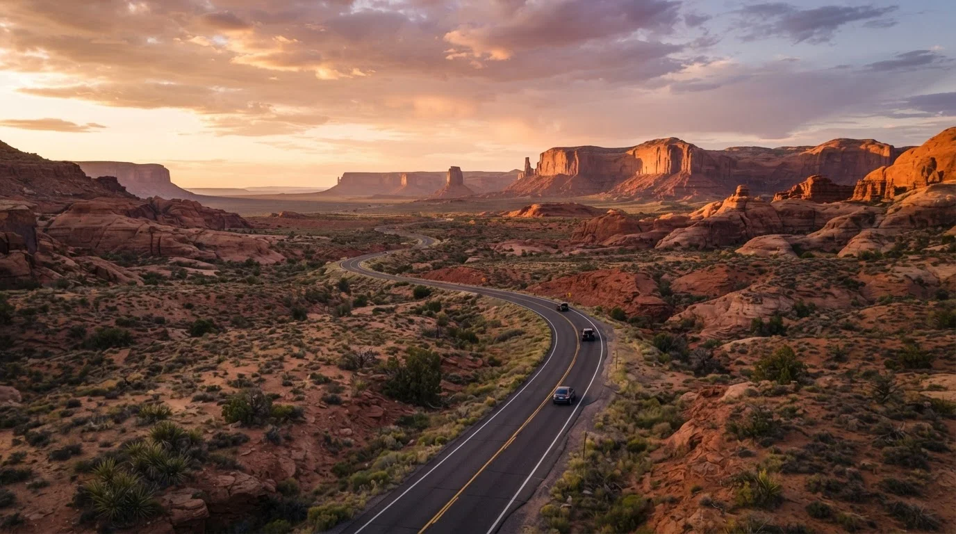
Photo credit: ProximityFinds.com | One-stop Reading Source
In this article
A quick-reference overview of America's most traveled and most scenic driving routes — what they are, where they run, and what distinguishes each one.
The Landscape of American Driving Routes
America's road trip culture runs deep - and for good reason. The country's highway system weaves through deserts, mountain passes, coastal cliffs, and Great Plains farmland, giving drivers an extraordinary range of experiences without ever leaving home soil. Whether you're planning your first big drive or adding a new route to a growing list, understanding how America's roads are categorized makes route-planning far easier.
At the broadest level, US driving routes fall into a few distinct categories: Interstate Highways (the familiar I-system), US Routes (older federal highways, often with more character), State Highways, and officially designated National Scenic Byways. Each has a different feel and serves a different kind of traveler. For a deeper look at what separates a merely long drive from a truly memorable journey, see our piece on what makes a route truly iconic.
Interstate Highway
A federally funded, controlled-access highway forming the core of the US National Highway System. Interstates are numbered - even numbers run east-west, odd numbers north-south.
US Route
Older federal highways predating the Interstate system, often passing through town centers and rural areas. Many, like Route 66, are beloved for their local character and history.
National Scenic Byway
A road designated by the Federal Highway Administration for outstanding scenic, cultural, historical, archaeological, recreational, or natural qualities. Designation does not change road ownership or management.
Parkway
A scenic road typically managed by the National Park Service, designed for passenger vehicles only. Commercial trucks and heavy vehicles are generally prohibited.
Pass elevation
The highest point a mountain road reaches before descending. High-elevation passes may close seasonally due to snow and ice; always verify road status before departure.
Iconic US Highways: A Quick-Reference Guide
These are the routes that show up on bucket lists - and for good reason. Each covers distinct terrain and connects culturally significant destinations.
- Route 66 (Chicago, IL → Santa Monica, CA)
- Stretching roughly 2,400 miles, the original "Main Street of America" passes through eight states, including Missouri, Oklahoma, Texas, New Mexico, and Arizona. Expect roadside diners, neon-lit motels, and classic Americana towns. Much of the original alignment runs parallel to I-40 through the Southwest.
- Pacific Coast Highway / US-1 (Northern CA → Southern CA)
- One of America's most celebrated coastal drives, hugging the Pacific from Leggett near the Redwoods south through Big Sur, Morro Bay, Santa Barbara, and into Los Angeles. The most dramatic segment runs between Carmel and San Simeon. A detailed comparison of these two iconic routes is available in our Pacific Coast Highway vs. Route 66 breakdown.
- Blue Ridge Parkway (Shenandoah NP, VA → Cherokee, NC)
- Running 469 miles along the spine of the Appalachian Mountains, the Blue Ridge Parkway is America's most visited unit of the National Park System. No commercial trucks are permitted - it's purely for travelers. Peak fall foliage season (mid-October) draws especially heavy traffic.
- US-89 (Arizona → Montana)
- Often called "America's scenic highway," US-89 passes by the Grand Canyon's North Rim, Bryce Canyon, Capitol Reef, and Glacier National Park across roughly 1,800 miles. It threads through the heart of the Southwest before climbing north - great fodder for those exploring the Southwest for the first time.
- The Going-to-the-Sun Road (Glacier NP, MT)
- Only 50 miles long, but among the most spectacular mountain drives anywhere in the country. This road bisects Glacier National Park, cresting at Logan Pass (6,646 ft). It is typically open only from mid-June through mid-October, depending on snowpack - always confirm current conditions before visiting.
If your preference leans coastal over alpine, or vice versa, our mountain vs. coastal drives comparison can help you decide which landscape suits your style.
National Scenic Byways and Hidden-Gem Routes
The Federal Highway Administration's National Scenic Byways Program designates routes for their cultural, historic, natural, recreational, archaeological, or scenic qualities. There are currently over 150 designated byways across 46 states - most of which see a fraction of Route 66's traffic.
150+
Designated National Scenic Byways in the US
According to the Federal Highway Administration's National Scenic Byways Program.
469 miles
Length of the Blue Ridge Parkway
The Blue Ridge Parkway is the most visited unit of the National Park System, per the National Park Service.
~2,400 miles
Original Route 66 alignment end to end
Running from Chicago, Illinois to Santa Monica, California through eight states.
A few standouts worth knowing:
- Natchez Trace Parkway (Nashville, TN → Natchez, MS): 444 miles of forested, largely commercial-free driving tracing an ancient path used by Native Americans and early American settlers. Zero traffic lights for most of the route.
- Highway 12 (Utah): Connecting Bryce Canyon with Capitol Reef National Park through Grand Staircase-Escalante, this 124-mile state highway is widely considered one of the most scenic roads in the entire country.
- Overseas Highway / US-1 (Florida Keys): 113 miles of bridges and causeways connecting the mainland to Key West - 42 bridges in total, including the famous Seven Mile Bridge.
- Beartooth Highway (Red Lodge, MT → Yellowstone): Topping out near 11,000 feet, this 69-mile route is only open May through October and is one of the highest paved roads in the continental US.
For routes that rarely make travel magazine covers, our underappreciated American drives guide surfaces some genuine hidden gems worth serious consideration.
Always Check Road and Seasonal Conditions
Many of America's most scenic routes - including the Beartooth Highway, Going-to-the-Sun Road, and Highway 12 through Utah - have limited operating seasons or are subject to weather closures. Before you depart, verify current road status with the relevant state DOT or National Park Service website. Conditions can change quickly, especially in mountain and desert environments.

Author
Travel Editorial Team
Travel Editorial Team is the collective byline for our editorial team and contributor network. Articles published under this byline or an editorial pen name are researched, written, and reviewed according to our editorial standards for clarity, consistency, and independence before publication.
View all articles →