
Pacific Coast Highway vs. Route 66: Two American Drives, Two Very Different Journeys
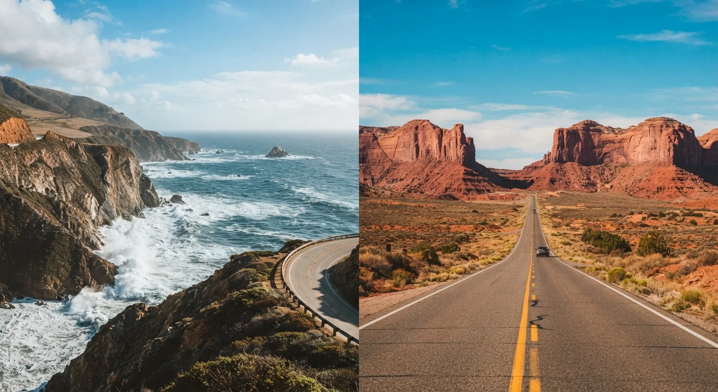
Photo credit: ProximityFinds.com | One-stop Reading Source
In this article
Coastal cliffs and beach towns versus desert towns and roadside Americana — a side-by-side look at two of America's most beloved driving routes.
Key Takeaways
- PCH runs roughly 650 miles along California's coast; Route 66 spans about 2,400 miles from Chicago to Santa Monica.
- PCH rewards you with ocean scenery and coastal towns; Route 66 delivers history, desert landscapes, and roadside kitsch.
- Route 66 requires significantly more driving time and planning due to its much greater length.
- Both routes can be driven in segments - you don't have to do the whole thing in one trip.
- Weather and season matter: PCH can have foggy summers; Route 66 summers can be brutally hot in the desert.
The Routes at a Glance
These two highways have both earned their legendary status - but they're built on entirely different promises. The Pacific Coast Highway (officially California State Route 1 along its most celebrated stretch) hugs the California coastline for roughly 650 miles, linking Los Angeles to the San Francisco Bay Area with dramatic cliff-side driving and Pacific vistas. Route 66, nicknamed the "Mother Road," stretches approximately 2,400 miles from Chicago, Illinois, to Santa Monica, California, crossing eight states and nearly every landscape America has to offer.
Understanding what sets them apart starts with understanding what each road was built to do. PCH is a scenic corridor - purpose-built for beauty. Route 66 was a practical lifeline, a migration path during the Dust Bowl era that later became a symbol of American freedom and wanderlust. To dig deeper into what makes either route earn the "iconic" label, check out what defines a truly iconic American road trip.
| Criterion | Pacific Coast Highway | Route 66 |
|---|---|---|
| Total Length | ~650 miles | ~2,400 miles |
| States Covered | California only | 8 states (IL to CA) |
| Typical Drive Time | 5-7 days leisurely | 2-4 weeks full route |
| Primary Scenery | Ocean cliffs, beaches, coastal towns | Deserts, plains, small towns, history |
| Route Complexity | Straightforward, single coastal road | Patchy - some sections bypassed |
| Best Season | Spring or fall (less fog) | Spring or fall (avoid desert heat) |
| Crowd Levels | High in summer, especially Big Sur | Moderate; varies by segment |
Scenery and Atmosphere
On the Pacific Coast Highway, the ocean is the co-pilot. From the jagged cliffs of Big Sur to the sandy stretches near Malibu, the scenery is consistently stunning in a way that rarely lets you forget you're somewhere special. Coastal towns like Carmel-by-the-Sea, San Luis Obispo, and Santa Cruz add charm and great stopping points. Fog is a real factor - coastal mornings can be socked in, especially June through August.
Route 66 trades consistency for variety. You'll roll through the flat farmland of Illinois, the quirky roadside attractions of Oklahoma, the painted desert of Arizona, and the Mojave before landing in Southern California. It's less about one dramatic visual and more about collecting moments: a neon-lit diner in Amarillo, a vintage motel sign in Tucumcari, or standing on the rim at a park stop in New Mexico. If you're trying to decide whether coastlines or open terrain call to you more broadly, this comparison of mountain routes vs. coastal drives is a useful read before you commit.
~650 mi
PCH's California coastal stretch
The scenic portion of California State Route 1 between Dana Point and Leggett covers approximately 650 miles of coastline.
8 states
States Route 66 passes through
Route 66 crosses Illinois, Missouri, Kansas, Oklahoma, Texas, New Mexico, Arizona, and California on its historic path west.
1926
Year Route 66 was officially established
Route 66 was commissioned as a US Highway in 1926, making it one of America's earliest numbered federal highways.
Logistics: Time, Cost, and Planning
A PCH trip between LA and San Francisco can be done leisurely in five to seven days with time to stop, hike, and linger. Fuel costs are manageable, lodging options range from budget motels to boutique inns, and the route is straightforward to navigate. Summer is popular - book accommodations well ahead in Big Sur, which has limited options.
Route 66 demands more commitment. A full end-to-end drive typically takes two to four weeks at a comfortable pace. Costs vary wildly depending on how many detours and overnight stops you make. Not all of the original Route 66 is intact - sections have been bypassed by interstates - so some advance research into which segments to prioritize is worthwhile. Both routes, however, can be driven in segments, which makes them accessible even if you can't take extended time off. For an honest look at the trade-offs of doing either alone, read about solo driving across the US.
Segment Driving Is a Valid Strategy
Neither PCH nor Route 66 requires an all-or-nothing commitment. Many travelers pick a single state or a 200-300 mile stretch and build a focused long-weekend trip around it. Big Sur alone, or the Arizona stretch of Route 66 through Flagstaff and Seligman, can each make for a deeply satisfying standalone adventure without requiring weeks of travel time or budget.
Which Drive Is Right for You?
If your dream road trip is defined by sweeping ocean views, fresh seafood, and a manageable week-long adventure, PCH is hard to beat. It's photogenic, relatively easy to plan, and delivers an emotional payoff quickly.
If you want to feel the full breadth of America - its history, its quirks, its small-town resilience - Route 66 is the deeper experience. It rewards patience and curiosity in ways a purely scenic route can't quite match. And if neither quite fits what you're looking for, know that there's a whole world of routes beyond the famous two - America's underappreciated drives are well worth exploring too.

Author
Travel Editorial Team
Travel Editorial Team is the collective byline for our editorial team and contributor network. Articles published under this byline or an editorial pen name are researched, written, and reviewed according to our editorial standards for clarity, consistency, and independence before publication.
View all articles →