
Driving the Mississippi River Road: One of America's Oldest and Most Storied Corridors
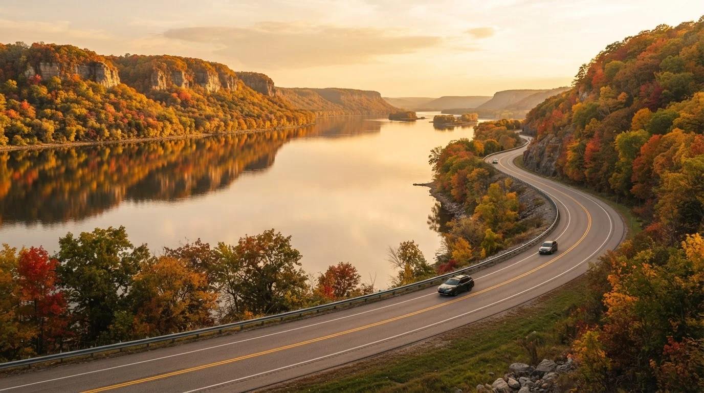
Photo credit: ProximityFinds.com | One-stop Reading Source
In this article
The Great River Road traces the Mississippi from Minnesota to the Gulf of Mexico. Discover the history, culture, and landscapes along this iconic American corridor.
Key Takeaways
- The Great River Road is a federally designated scenic byway spanning roughly 3,000 miles across 10 states.
- The route passes through Native American heritage sites, Civil War landmarks, and iconic American music birthplaces.
- Driving the full corridor can take two to three weeks; shorter regional segments work well for weekend trips.
- Autumn and spring offer the most comfortable driving conditions and striking scenery.
- Always verify road conditions, seasonal closures, and ferry schedules with state DOT sources before departing.
What Is the Great River Road?
The Great River Road is a federally designated National Scenic Byway that follows the Mississippi River from its headwaters at Lake Itasca in northern Minnesota all the way down to the river's mouth near Venice, Louisiana. It stretches roughly 3,000 miles and passes through 10 states: Minnesota, Wisconsin, Iowa, Illinois, Missouri, Kentucky, Tennessee, Arkansas, Mississippi, and Louisiana.
Unlike an interstate built for speed, the Great River Road is engineered for discovery. It weaves through small river towns, climbs limestone bluffs with sweeping valley views, and dips into floodplain landscapes teeming with wildlife. A green pilot's wheel sign marks the official route, though the exact roads used vary by state - a mix of state highways, county roads, and local streets. For context on what separates drives like this from ordinary highways, see what makes a route truly iconic.
~3,000
Total miles of the Great River Road
The route spans 10 states from Lake Itasca, Minnesota, to the Gulf of Mexico near Venice, Louisiana.
10
States the corridor passes through
The federally designated byway crosses Minnesota, Wisconsin, Iowa, Illinois, Missouri, Kentucky, Tennessee, Arkansas, Mississippi, and Louisiana.
261
Miles of Upper Mississippi Wildlife Refuge
The Upper Mississippi River National Wildlife and Fish Refuge is one of the longest stretches of protected river habitat in the country.
The Route: From Minnesota to the Gulf
The northern stretch, from Lake Itasca through the Twin Cities, is quieter and more wooded - think dense pine forests giving way to river-carved bluffs. Once you cross into Wisconsin and Iowa, the Upper Mississippi River National Wildlife and Fish Refuge stretches across hundreds of miles, making this one of the richest bird-watching corridors in North America.
Through Illinois and Missouri, the landscape opens up. The confluence of the Missouri and Mississippi Rivers near St. Louis is a landmark moment on any southbound drive. Below the Missouri border, the character of the route shifts noticeably - antebellum architecture appears in small towns, the river grows wider and more powerful, and the humidity rises. By the time you reach the Mississippi Delta in Mississippi and Louisiana, the river feels ancient in a way that's hard to put into words.
If you're comparing this route to other American classics, the US road trip route reference offers a useful overview of how the Great River Road fits among other scenic byways.
Drive Both Banks When Possible
The Great River Road runs along both the Minnesota/Iowa side and the Wisconsin/Illinois side in the Upper Mississippi. Whenever a ferry or bridge crossing allows it, switching banks gives you a completely different perspective on the same landscape. The western bluffs and the eastern floodplains each tell their own story.
History and Culture Along the Corridor
Few American roads carry as much history per mile. Indigenous peoples have lived along the Mississippi for thousands of years, and Cahokia Mounds State Historic Site in Illinois - a UNESCO World Heritage site - preserves one of the largest pre-Columbian settlements north of Mexico. Further south, the Natchez Trace intersects the corridor, connecting river culture to overland trade routes used since the 1700s.
Civil War battlefields dot the lower half of the route; Vicksburg, Mississippi, where a 47-day siege in 1863 helped turn the war's tide, is among the most significant. And then there's the music: the Mississippi Delta gave birth to the blues, and towns like Clarksdale and Greenville remain living museums of that heritage. This is a drive where the underappreciated depth of American roads shows most clearly.
“The Mississippi River will always have its own way; no engineering can persuade it otherwise.”
— Mark Twain, Author and Mississippi River steamboat pilot
Must-Stop Towns and Highlights
Certain stops on the Great River Road are worth slowing down for significantly:
- Winona, Minnesota - Victorian-era architecture perched between river and bluffs; excellent hiking at Garvin Heights Park.
- Dubuque, Iowa - A former lead-mining hub with a beautifully preserved 19th-century downtown and access to Effigy Mounds National Monument nearby.
- Hannibal, Missouri - Mark Twain's boyhood home, where Adventures of Huckleberry Finn and The Adventures of Tom Sawyer were rooted.
- Natchez, Mississippi - One of the oldest cities on the river, with antebellum plantation houses, a bluff-top park overlooking the water, and a rich, complex history.
- New Orleans, Louisiana - The spiritual and culinary finale of any southbound drive; jazz, Creole food, and a streetcar culture unlike anywhere else in the country.
Pick up the official state byway maps at welcome centers rather than relying solely on your phone's GPS - they show ferry crossings, overlooks, and historic sites that navigation apps frequently miss.
The Great River Road uses a patchwork of local and state roads; without the dedicated byway map, it's easy to accidentally bypass the most scenic segments.
If you're only doing one segment, prioritize the stretch from Winona, Minnesota, to Dubuque, Iowa - the bluff scenery here is among the most dramatic on the entire corridor and remains relatively uncrowded.
This Upper Mississippi section combines geological drama with accessible river towns and wildlife refuges, offering a concentrated taste of what makes the full route special.
Planning Your Drive: Practical Tips
The full route is best approached as a two-to-three-week journey if you want to absorb it properly. Many travelers, however, drive it in segments over multiple trips - the Upper Mississippi from Minnesota to St. Louis, or the Lower Mississippi from Memphis to New Orleans, each stand on their own as satisfying experiences.
Navigation deserves extra attention: the green pilot's wheel signs are helpful, but GPS can sometimes route you away from the scenic byway onto faster roads. Download offline maps and cross-reference the official state byway maps, available through most state tourism offices. Some sections use ferries to cross the river - check schedules in advance, as many operate seasonally and have limited daily crossings.
Verify Local Conditions Before You Depart
The Great River Road passes through areas prone to seasonal flooding, and some roads may be temporarily closed or rerouted. Always check current advisories through official state DOT sources and consult the official Great River Road state partner websites before each segment of your trip. Do not rely on a single navigation app as your sole source of route information.
For comparison with other domestic drives that take a very different tack, the Pacific Coast Highway vs. Route 66 comparison and the American Southwest road trip overview offer useful contrast in terrain and pacing.
Best Time to Travel and Seasonal Considerations
Autumn - roughly late September through early November - is arguably the finest season for the northern and middle sections of the route. The hardwood bluffs above the river explode in color, temperatures are mild, and crowds are manageable. Spring (April-May) brings wildflowers to the upper corridor and pleasant driving conditions before summer heat sets in.
Summer is busy and hot, particularly in the lower states, where humidity and temperatures regularly exceed 90°F. Flooding is a genuine concern along low-lying stretches of the route in spring; always check current river levels and road closures via official state DOT sources before you go. Winter driving in Minnesota and Wisconsin can be challenging, and some ferry crossings and visitor sites close seasonally.
Watch for Seasonal Road and Ferry Closures
Spring flooding can close low-lying stretches of the byway without much notice, and several river ferry crossings operate only from spring through autumn. Before finalizing your itinerary, check road status with each state's Department of Transportation website and confirm ferry schedules directly with operators. Conditions can change quickly along the river corridor.
However you slice it, the Great River Road rewards patience. This isn't a drive you blast through - it's one you settle into, letting the oldest river in the country tell you its story mile by mile.

Author
Travel Editorial Team
Travel Editorial Team is the collective byline for our editorial team and contributor network. Articles published under this byline or an editorial pen name are researched, written, and reviewed according to our editorial standards for clarity, consistency, and independence before publication.
View all articles →